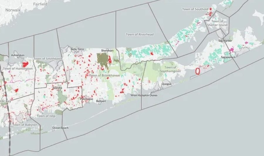
The bottom line is that 89% of the buildable land in Nassau and Suffolk counties allow the construction of single-family housing, 8.5% permit two-family housing, and 3.6% approve the construction of housing for three or more families. For a suburban region with almost 3 million residents, this is both extraordinary and shocking, and it does not bode well for the future. (As one comparison, in Connecticut, 27.6% of the buildable land allows two-family housing.)
One of Long Island’s most pressing problems is the lack of housing — for young people just starting out, for people on limited incomes, and for people who want to give up their single-family home and find something smaller. The Long Island Index, which the Rauch Foundation published, talked about these issues from its first publication in 2003. The issue has only grown in importance since then, in part exacerbated by the pandemic and worsened by the lack of a meaningful increase in multifamily housing.
Yes, some new housing is getting built on the Island. But all too often, opposition from local communities turns a good family-oriented proposal for multifamily housing into a plan for senior housing. We need families. We need children. We need the vitality and the invigoration for our communities. We need it for our economy. If we are going to expand our businesses and grow our economy, we have to expand our housing options and especially those options in short supply today: multifamily housing, duplexes, accessory dwelling units, town houses, and more. They need to be available for young people and families with school-age children, not just seniors.
The Long Island Zoning Atlas project grew out of an effort that Rauch and The New York Community Trust – Long Island started to help advance the discussion about housing. It was clear we needed new tools to help people understand the facts about our situation. We were impressed with the work of a group of housing advocates based in Hartford, Connecticut that created the first statewide zoning atlas. Since that time, their atlas has become part of the National Zoning Atlas and 22 states are working on their own set of maps. The Long Island Atlas will become part of the larger New York State project.
Creating the Atlas for Long Island was time-consuming and complex. Our many layers of government are divided into more than 1,200 zoning districts. Each district has its own rules and regulations which were carefully recorded, along with more than 100 attributes. Sometimes we had to work with hand-drawn maps of a zoning district made decades ago because no work had been done to digitize them. We invite Long Islanders to look at their own communities and see what is allowed.
Long Island’s zoning was largely laid down in the 1950s. Updating it for today’s needs is an urgent necessity. The new Long Island Zoning Atlas is a powerful tool that creates a picture of what is allowed today and allows the user to see what could be built if only we would update our zoning regulations to better match the needs of our communities.
This guest essay reflects the views of Nancy Rauch Douzinas, chair of the Rauch Foundation, and Sol Marie Alfonso-Jones, senior program director of The New York Community Trust – Long Island.


