Affordable housing is an urgent issue on Long Island, where one third of homeowners and half of renters spend more than 30 percent of their income on housing. As income inequality increases across the Island and more residents struggle to meet basic needs, the median cost of a home has surpassed $600,000—making buying or renting a stable home even more out of reach for many Long Islanders.
While advocates have worked to address this issue, there is often no clear path to policy change on Long Island. The most populated island in the United States has a complicated municipal structure, with more than 1,200 overlapping zoning districts for its 13 towns, two cities, 100 villages, nearly 200 unincorporated hamlets, and 127 school districts.
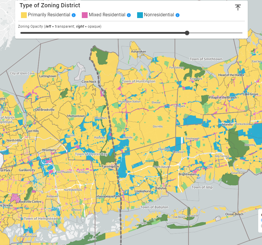
Long Islanders have long sought clarity on their region’s maze of zoning ordinances. For years, local advocates have called for transparent and accessible zoning data to help them organize for more affordable housing across all communities.
In response to these calls, The Trust’s Long Island office (formerly known as the Long Island Community Foundation) worked with the Rauch Foundation to help the CUNY Mapping Service at the CUNY Graduate Center’s Center for Urban Research, Community Development Long Island, and the Regional Plan Association develop an online zoning map of Long Island.
The Long Island Zoning Atlas—the first tool of its kind in New York State—went live in December 2023.
Online Atlas users can click on a location or enter an address to discover how it is zoned—for example, as primarily residential, mixed-residential, or nonresidential; how many housing units may be built; and whether creating more housing would require a public hearing. The Atlas also provides web links to relevant zoning ordinances and filters to identify the elected officials representing each district.
“The Atlas democratizes data for Long Islanders who lack centralized municipal services, and it will help local governments promote needed zoning reforms,” said Sol Marie Alfonso-Jones, The Trust’s senior program director for Long Island. “We helped create an accessible tool for a variety of users to understand what is possible for housing within their communities and thus increase their participation in land-use decisions.”
As of August 2024, the Atlas boasted 6,700 users, who account for more than 11,550 visits. From students to developers, the Atlas serves a wide range of Long Islanders.
“By promoting smart and sustainable growth, we can enhance economic stability for all Long Islanders—ensuring that safe, quality housing remains accessible and that our communities thrive,” Alfonso-Jones said.